|
|
Deadwood Mountain Fire LookoutA California Department of Forestry and Fire Protection Tower in Cooperation with the Sierra National ForestMadera, Mariposa, Merced Ranger UnitFormerly a U.S.F.S. Lookout. |
![]()
![]()
|
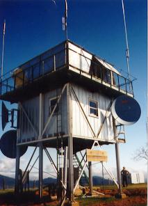
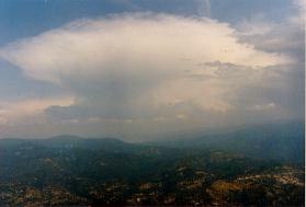
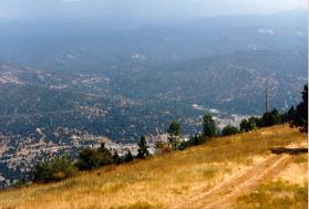
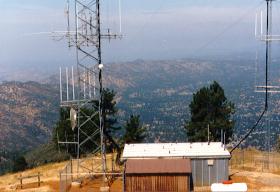
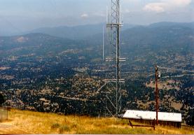
Deadwood Lookout Tower is located at T7S, R21E, S21 of the U.S.F.S. Map, at an elevation of 4,540 feet. The photo of the tower was taken during winter closure of the tower in 1993. The tower has been retired from active service since the end of the 1994 fire season and was staffed by paid or volunteer lookouts while it was in service. The tower is now in extreem disrepair condition as of the last photo I saw in 2008. The original tower was constructed in 1905 and was of a wood cabin design. The lookout was staffed through out the 1909 season and was the first continually staffed lookout in the Sierra National Forest. In 1911 the cabin was removed and replaced with a 20 foot pole support and a 7 x 7 foot wood type cabin, with a 12' x 12' hip roof built on the base of the tower. An early type of the Osborn Fire Finder was developed here sometime during the period. The phone line and trail to the summit were also put in during 1911. In 1920 the cabin was again removed and replaced with a steel aermotor type tower. In 1932 the tower was replaced with a 20 foot, H-Beam Steel Tower with a L-4 or 4AR Cab on top. In 1952 the Cab was replaced with the current C-3(L) Cab. Currently the tower was of 1932 design with a 1952 cab on top. The tower is located on private leased land outside the National Forest Boundry. While in service the tower was a joint venture of the U.S. Forest Service and C.D.F., which is now known as CalFire. |
![]()
Click on image to view it in a seperate window.
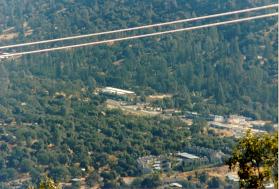
Left photo: North Oakhurst, Hwy 41 area and Right photo: Downtown Oakhurst area.
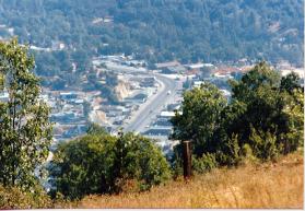
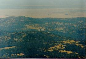
Left photo: Yosemite National Park area and Right photo: Oakhurst Valley, Hwy 49 &41 area.
Left photo: Windy Gap, Gold Side area and Right photo: Road 628 & Road 620 area.

Left photo: Table Mountains, East of Hwy 41 area and Right photo: Madera Valley, Raymond area.
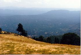

Left photo: Bass Lake, Goat Mountain area and Right photo: Thornberry Mountain area.
Our communities thanks to the CDF V.I.P. Volunteers who helped staff the lookout before it was removed from service.
![]()
| These are private web pages and are not maintained by any governmental agency, all representations are for educational and informational purposes only! See Disclaimer and Legal Stuff for more details. |
1995 Miami Mountain Volunteer Fire Lookouts
fire-lookouts.org
All Rights Reserved