
|
|
Mount Tom Fire LookoutLocated in the United States Forest Service'sSierra National Forest, Minerets Ranger District |
![]()
Mt. Tom's GPS location is 37.2235°N / 119.1048°W, Placed on the National Historic Lookout Register on 4/21/1999 as Lookout No. 306 |
![]()
|
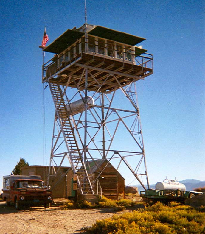
Mt. Tom Lookout is located at an elevation of 9,018 feet, and is closed during the winter months due to heavy snow levels. There is access to the tower and surrounding area to the general public during the summer when the tower is open for service. The towers map location is Township 6 South, Range 26 East, Section 30 on the Sierra National Forest Map and is located in the State of California (County of Fresno), in the Sierra National Forest. The tower has a three story stair master built into the tower to reach the cab and stands 34 feet from the ground. :-)) Mt. Tom Lookout was originally one of the last lookouts constructed by the Cililian Conservation Corps (CCC) in 1934 as a compass lookout with a steel structure base. Mount Tom Lookout is shown in the center of the topographic (topo) map, which is sourced from the United States Geographical Survey's (USGS) Balloon Dome Quad Map. The nearest major town is Mono Hot Springs, CA. Looking north at the lookout tower which was built by the CCC in 1934. It is in a spectacular location on a peak north of the Kaiser Wilderness, Balloon Dome, Lake Thomas A. Edison, The Seven Gables, The Minarets and Ansel Adams Wilderness. FFLA (Forest Fire Lookout Association) Reports for the year:2010Maintenance was done on the tower with most of the labor being done by BRF volunteers over several project work weekends throughout the summer of 2010. Mt Tom received new cabinets, a new floor, and plumbing upgrades. 2011A new roof and outhouse are scheduled to be constructed at Mt Tom in the near future. |
![]()

|
Previewing QTVR panoramas requires the QuickTime plug-in, Click here to Download. Click on thumbnail above to view the 1/2009 panorama, it is a large high resolution panorama and it will take sometime to download, but well worth it. The following is a photo pan from the lookout with a brief description. Also, clicking on the photo will open a seperate 150kb+/- high resolution window for better viewing. |
![]()
|
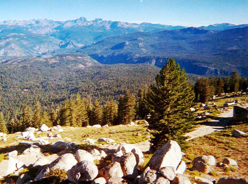
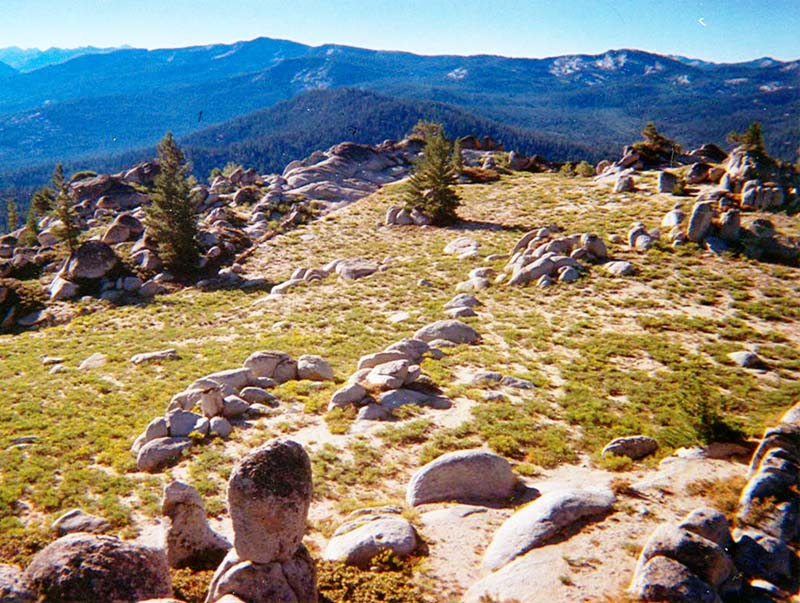
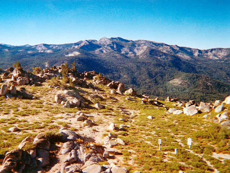
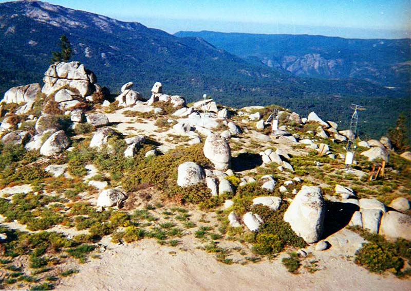
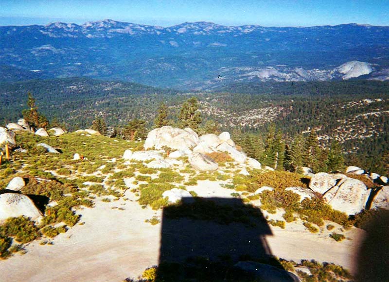
Looking North towards San Joaquin River Canyon, Mt. Ritter and Minarets Peak. Looking Northeast towards (L. to R.) Mammoth Mountain, Pincushion Peak, Sharktooth, Silver Peak and Saddle Mountain. |
|
Looking East towards Edison Lake (Can't see due to low water), shinny point is water from the South Fork of the San Joaquin River. Looking Southeast (L. to R.) Kings Canyon National Park, Mt. Givens, White Bark Vista, Kaiser Pass and Potter Pass w/3 Sisters. |
|
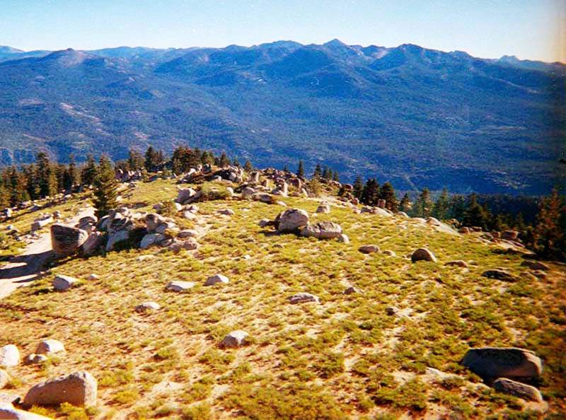
Looking South towards Kaiser Peak. Looking Southwest towards RAWS Station (Rt. forground) and flat ridgeline is Wiskey Ridge |
|
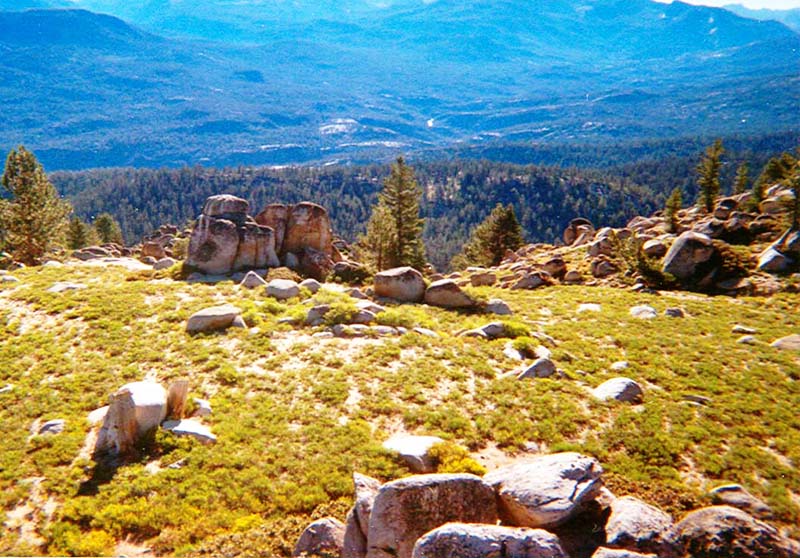
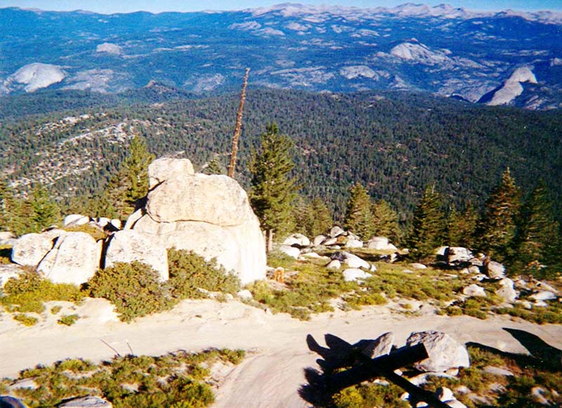
Looking West before the cell tower, towards (L. to R.) Rocky Ridge, Eagle Beak, Big Shuteye (L.O.), Little Shuteye Pass and Little Shuteye. Looking Northwest towards (L. to R.) Fuller Buttes, Jackass Rock, Balls, Squaw Dome, Ballon Dome, Rockey Ridge line and the Southeast border of Yosemite National Park. |
|
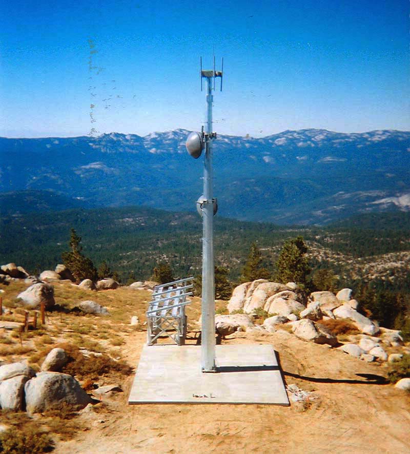
Looking West at Ponderosa Phone Co. cell tower on top of Mount Tom Photos courtesy of Tom Payne lookout who worked 20 years at Mount Tom Lookout and is now retired, all rights reserved. |
![]()
| These are private web pages and are not maintained by any governmental agency, all representations are for educational and informational purposes only! See Disclaimer and Legal Stuff for more details. |
1995 Miami Mountain Volunteer Fire Lookouts
fire-lookouts.org
All Rights Reserved