Example of web page: NAME - title OF Fire Lookout
DESCRIPTION OF Located in the LOCATION
DESCRIPTION OF WHAT Forest, WHAT Ranger District
![]()
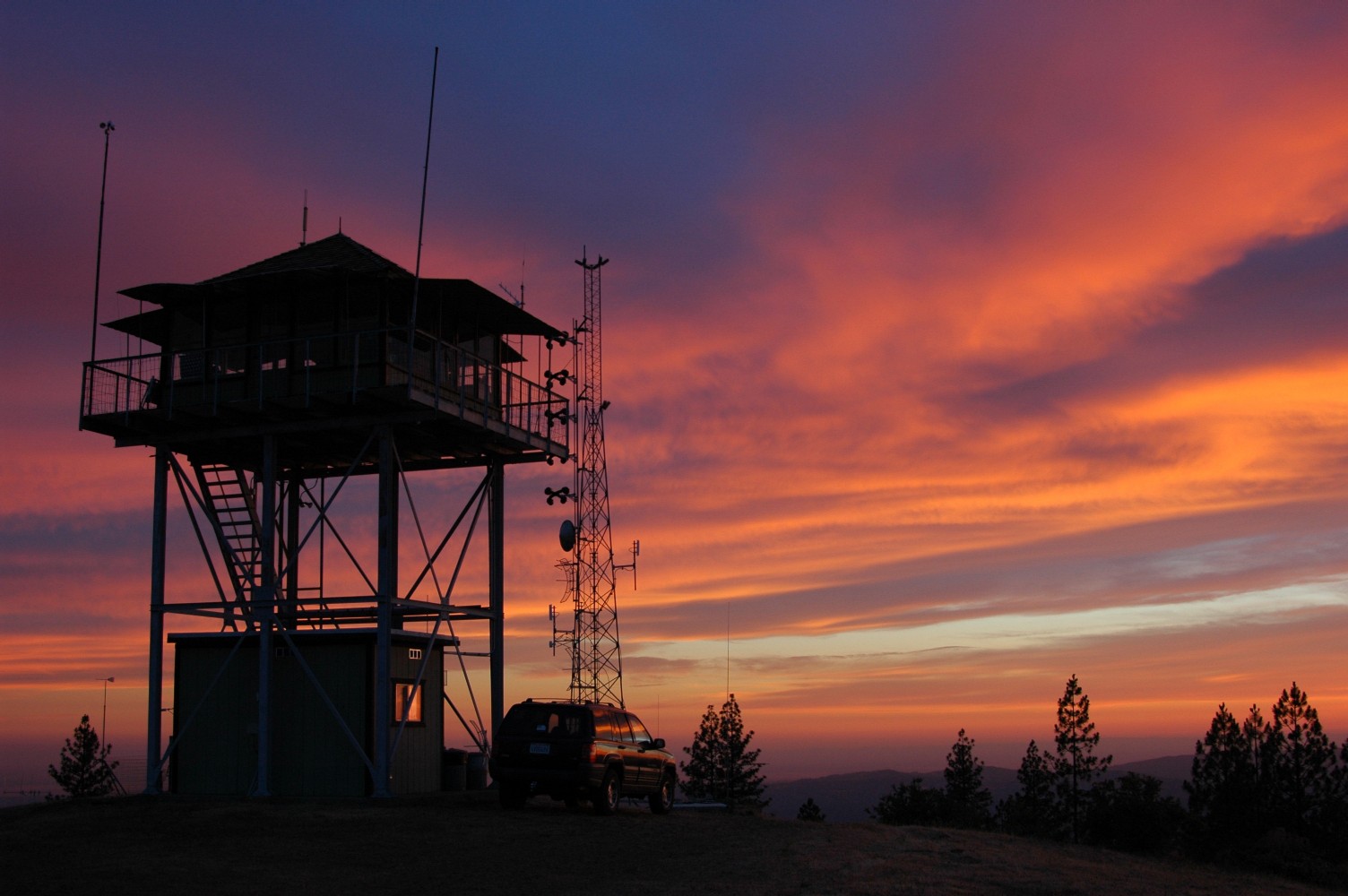
The Lookout's GPS location is placed here: ??.?????°N, ???.?????°W
|
General information of the Lookout and location is placed here: "LOOKOUT NAME" Lookout located at "ELEVATION IN FEET" feet in elevation, has been "STATUS OF TOWER" closed for several years now due to Forest Service funding cutbacks. There is "DETAILS OF PUBLIC ACCESS" no access to the tower or surrounding area to the general public short of hiking. The towers "MAP LOCATION" map location is Township ? South, Range ?? East, Section ?? on the "NAME OF" Forest Map "IF ANY". More detailed information about the tower and known history are placed here: LOOKOUT NAME, TYPE OF TOWER, DETAILS OF CONSTRUCTION, WHEN BUILT, WHEN PUT INTO SERVICE, AND SOME HISTORY ON THE TOWER. AN EXAMPLE: Lookout was originally constructed in 1900 as a compass lookout. In 1911 it was rebuilt as a 12' x 16' cabin by Ray Smithers. It had windows on all four sides and a phone was installed. In 1916 a octagonal second story was added to the cabin. In 1926 a 4AR type house was constructed. The 14' x 14' wood hip roofed lookout house had a steep 12/12 pitch roof with 2 pane windows and door in the center of the wall. In 1951 the lookout was rebuilt in the current configuration as it is today. The C-3(L) type tower is a 14' x 14' hip roofed wood tower standing on a 10' x 10' concrete block base.
A PANORAMIC VIEW FROM THE TOWER WE WILL BE CREATED HERE IF ALL .JPG PHOTOS SUBMITTED MEET THE REQUIREMENTS FOR NEEDS TO STITCH THE PAN. PHOTOS NEED TO BE TAKEEN WITH A 5.0 MEGAPIXEL OR BETTER DIGITAL PHOTOS OVERLAPPING BY 25 PERCENT SO THEY CAN BE STICHED TOGETHER TO MAKE THE 360 DEGREE VIEW FROM THE TOWER. PHOTOS MUST BE TAKEN FROM EACH CORNER OF THE TOWER WITH THE SAME FOCAL LENGTH AND EACH PHOTO OVERLAPS BY 25 PERCENT OF THE FRAMES OF THE PICTURE. THIS PANORAMA IS OPTIONAL FOR THE TOWER WEBPAGE. Click on the thumbnail above to view the 10/2008 panorama full size. A FIXED PHOTO PAN TAKEN FROM THE LOOKOUT TOWER WILL BE PLACED BELOW. THE PICTURES NEED TO BE 5.0 MEGAPIXEL, OR MORE, DIGITAL PHOTOS. TWO PHOTOS TAKEN FOR EACH DIRECTION AND DESCRIPTION OF DIRECTION OF PHOTO SHOULD BE ENCLOSED. THEY SHOULD BE FULL SIZE .JPG FILES. ONE WILL BE COMPRESSED TO 100 DPI FOR THE WEBPAGE AND ONE FULL SIZE WILL BE RETAINED ON THE SITE FOR THE DETAILED "ON CLICK DISPLAY" OF THE PICTURE IN THE WEBPAGE. The following is a photo pan from the lookout with a brief description, the photos do overlap. Also clicking on the photo will open a seperate 450kb+ high resolution window for better viewing of the photo. |
![]()
Note about photo: 10/2008 looking North into National Park and North & East into Y.N.P..
Note about photo: 10/2008 looking East & North into N.P. and East into Basin.

Note about photo: 10/2008 Looking South & East into and the National Forest.
Note about photo: 10/2008 Looking South towards Peak & Mountain just right of peak and South & West into & Valley.
Note about photo: 10/2008 Looking West towards Mountain & and North & West into the River Canyon.
Credits posted here: Photos courtesy of NAME, all rights reserved.
The tower history was provided by NAME and was compiled from several sources.
![]()
This page last updated on March 1, 2013.
|
These are private web pages and are not maintained by any governmental agency, all representations are for educational and informational purposes only! See Disclaimer and Legal Stuff for more details. |
1995 Miami Mountain Volunteer Fire Lookouts
fire-lookouts.org
All Rights Reserved